NHBR About Town: Week of July 17, 2026
Business and event happenings around the state of NH
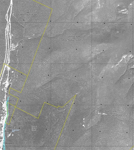
As part of the Federal Emergency Management Agency’s nationwide program to modernize flood insurance rate maps, it has released online new preliminary maps of the Town of Lincoln and a flood insurance studies of all jurisdictions in Grafton County.
Flood insurance rate maps indicate whether properties are in areas of high, moderate or low flood risk. Community officials and residents are encouraged to examine the new preliminary flood maps to become familiar with flood risks in their community and see whether the flood zone has changed around their property, said a FEMA press release.
In reviewing the new maps for the Town of Lincoln, many property owners may find that their risk of flooding is higher or lower than they thought. If the risk level for a property changes, so may the requirement to carry flood insurance.
The maps have been updated using new elevation data and analysis of the East Branch of the Pemigewasset River in the Town of Lincoln. FEMA will work with the Town of Lincoln to determine a path forward for potential accreditation of the Lincoln Flood Control Dike, also referred to as the Lincoln Levee.
Once FEMA and the Town of Lincoln determine that the maps will proceed towards becoming effective, there will be notification of a 90-day comment/appeal period, during which the public may comment on or appeal the mapping analysis by presenting scientific or technical data supporting their position. The flood insurance rate maps and flood insurance studies will become effective approximately eight months after resolution of any comments or appeals received.
The maps can be viewed at each community’s municipal office, or online at the FEMA Map Service Center, where a state and then county must be selected before clicking on “Get Preliminary FEMA Map Products”. Scroll down to the bottom of the FIRM listing and click on the index panels to find your location. Once you have found your location, note the panel number then go back to the FIRM listing and click on the panel number desired. Every community will receive both a paper copy and a digital copy of the new maps to share with their residents for review before the maps become finalized.

Business and event happenings around the state of NH

The Latest is a roundup of the comings and goings of the movers and shakers in NH's business community
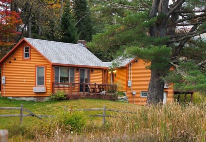
A decade after buying the property to redevelop it into a new generation of vacation cabins, the owner of Presidential Mountain Resort LLC (PMR) in Bethlehem has filed for bankruptcy protection in New York’s federal court, claiming more than $13 million in liabilities owed.

Failure to restore ACA tax cuts will only make things worse, according to U.S. Sen. Maggie Hassan

One of the things I enjoy most about working with New Hampshire business owners is hearing what they’re building toward. Whether it’s growth, succession or greater stability, our conversations are almost always about the future.

For many business owners, building wealth is closely tied to the success of the company. But as revenue grows and priorities shift, it can be difficult to know how much cash to keep available, how much to reinvest and when to begin planning for longer-term goals.

Succession planning for your business goes beyond naming the next leader. It involves preserving continuity for your employees and customers, as well as supporting the company’s long-term success.

As we close out Q2 and review the year so far, there are several interesting dynamics at play.

Londonderry’s Town Council is at odds over legal matters pertaining to hiring outside law firms to handle complaints and allegations of misconduct against the town manager.