(Opinion) Take the SBA 250 Small Business Pledge
Celebrate the nation’s 250th birthday with an entrepreneurial spirit
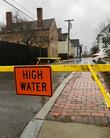
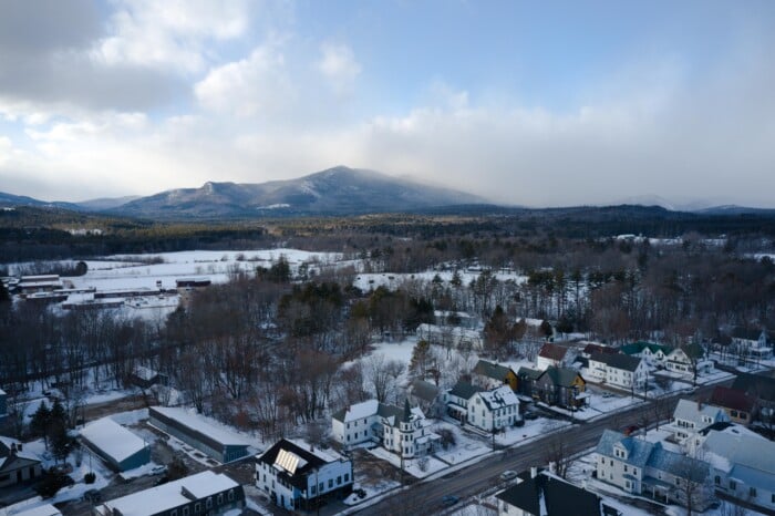
Researchers at the University of New Hampshire have found that in the past 20 years roads along the East Coast have experienced a 90 percent increase in high tide-related “nuisance flooding,” often making the roads in affected communities impassable, causing delays, as well as stress, and impacting transportation of goods and services.
In their study, published in the journal Transportation Research Record, the researchers found that tidal nuisance flooding threatens over 7,500 miles of roadways along the entire East Coast, with over 400 miles of that being interstate roads. They estimate that this causes over 100 million hours of delays each year for drivers on those roads – and that number could rise to more than 3.4 billion hours by 2100.
By the middle of the century (2056-2065), they predict nuisance flooding could occur almost daily at specific sites along the shores of Connecticut, New Jersey, Maryland, the District of Columbia, North Carolina, and Florida under an intermediate sea level-rise scenario.
“As tidal coastal flooding increases in the coming years, there will also be issues with the transportation infrastructure,” said Jennifer Jacobs, a UNH professor of civil and environmental engineering. “We’ve already seen billions of dollars in damage to coastal roadways from recent hurricanes. In the future, with rising sea levels, we expect to see more frequent issues, more damage, and impact to roadways even farther inland.”
Researchers note that these impacts are not limited to storm events. They say that critical transportation infrastructure is at risk from sea level rise alone; which numerous transportation agencies project to be between one to eight feet, along the U.S. Atlantic and Gulf Coasts.
The researchers say that the goal of this study is to better understand the type and extent of roadway infrastructures that are vulnerable to high-tide flooding and the transportation impacts now and in the future due to sea level rise.
Vulnerable roads were identified using data from the Federal Highway Administration’s Highway Performance Monitoring System and National Oceanic and Atmospheric Administration’s Center for Operational Oceanographic Products and Services. They looked at flood frequency maps, tidal gauge historic observations, and future projections of annual minor tidal flood frequencies and durations.

Celebrate the nation’s 250th birthday with an entrepreneurial spirit
U.S., Canada demonstrate the value of reliable partnership across the border

Without affordable housing, young people cannot afford to be here. Nowhere in the state is the need to attract younger populations more of an economic priority than in rural communities.

Managers would be wise to pay attention to what their reports have to say

Sustainable investing has undergone a reset. The excitement and lofty promises that accompanied the rise of ESG have given way to skepticism, political debate and a healthy demand for accountability.

Now that the filing period for political office is over, things have become a little clearer. Who is running and who is not, and choices facing the voters have become focused.

A roundup of news updates from public companies in NH and nationwide

New Hampshire entrepreneurs Ken and Grace Solinsky are experienced in creating businesses. On July 7, they cut the ribbon on something much more — an industrial, residential, child care, retail strip, all rolled into one.

NH Business Review's biweekly snapshot of business and industry statistics