It’s (still) the economy, stupid
Back in 1992, political strategist James Carvell came up with the phrase, “It’s the economy, stupid,” to help Democrat Bill Clinton defeat incumbent Republican President George H.W. Bush.
The New Hampshire Zoning Atlas continues to deepen its knowledge and utility with two updates having to do with child care and state-owned property.
The child care element seeks to reflect changes to local regulations for both family and center-based care as a result of the latest legislative action on the issue. Included in this is HB 1195, signed into law earlier this month by Gov. Kelly Ayotte, which allows, by right, family and group child care as an accessory use in any residential zone or commercial zone without local site plan review.

Elissa Margolin is the director of the Initiative for Housing Policy and Practice at Saint Anselm College in Manchester. (Courtesy photo)
The state-owned property element looks at what land currently controlled by the state might be suitable for residential housing development. Earlier this year, Ayotte called for a review of state-owned land as part of what she described as “more creative ways that we can expand the opportunities for housing in New Hampshire.”
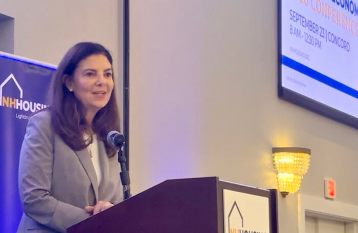
“We’ve been looking at that issue in my office, and looking at creative ways, not just what do we own, but what are appropriate pieces that we’re not utilizing and we don’t need as a state,” she said at a March conference hosted by New Hampshire Housing.
The two issues — housing and child care — go hand in hand as significant factors in the state’s economic health, according to Elissa Margolin, director of the Initiative for Housing Policy and Practice at Saint Anselm College.
“Essentially both of those things are essential to recruiting and retaining your workforce,” Margolin said. “As others age out of the workforce, you want to make sure that you have younger people coming in and keeping our economy vital and vibrant. We need a place for the workforce to live, and we need a place to care for young children.”
The Housing Atlas was first introduced in May 2023, created as a collaboration among Saint Anselm College, New Hampshire Housing, and the state Department of Business and Economic Affairs (BEA) as a tool to catalog and compare local zoning regulations across every municipality in the state.
It’s been tweaked along the way with new layers of information, for example, on the availability of sewer and water infrastructure throughout the state, an important component when it comes to new housing development.
“The data and the findings about the limitations that we have in the state due to very limited public water and sewer infrastructure has led to just so much good conversation,” Margolin said. “We’re going to continue to update the atlas, so that it’s relevant to the prosperity of our state, wherever we can add value.”
The atlas has been adjusted before as policy changed in the state to address the pressing need for more child care centers, whether in a home or commercial setting.
The New Hampshire Fiscal Policy Institute (NHFPI) has on several occasions highlighted studies that show child care here is not only scarce but unaffordable for many parents.
When it comes to percentage of income spent on child care, New Hampshire comes out pretty well in a national study — among the lowest at No. 39, according to a recent WalletHub review.
Nebraska has the greatest financial burden for child care — 10.68% of the median annual income of a married couple for family-based care, 13.58% for center-based care. The Granite State, according to WalletHub, came in at 7.31% of median income for family care, 9.29% of income for center care.
With the latest legislative-mandated changes, the atlas researchers are examining how local land use regulations affect access to child care providers across New Hampshire. Building on recent state legislation, the project will map the needed changes to local regulations for both family and center-based child care.
“There’ll be a process of making those changes,” said Margolin, noting that the changes should be reflected in an updated map by the end of 2026.
The state-owned land part of the update was actually initiated by a call from the efficiency commission empaneled by Ayotte soon after she took office in January 2025. Her Commission on Government Efficiency (COGE) was created to identify opportunities for the state government to operate more effectively and reduce costs.
“We were contacted by leaders in the committee on government efficiency, so the COGE commission, and then asked if our atlas could shed any light on state-owned land assets that might be good prospects for additional housing supply in the state,” she said.
The analysts have worked to set up screening criteria of what might be suitable for development based on a number of factors, including access to sewer/water, wetlands/floodplain, and road frontage. Also included in that matrix is the local labor market.
“You need to match that where there’s market demand for housing, right? So there might be parcels where there’s no demand,” she said.
The mappers are about 12 weeks from finishing the update, according to Margolin.
“I think we’re going to find there’s an opportunity for more housing production,” she said. “But the road to get there is one for state leaders and policy makers to figure out.
As with the water/sewer infrastructure update, Margolin suspects it’ll spark a conversation.
“I think it’ll be similar when this report is completed. I think we’ll understand that every parcel has, depending on the agency, its own road to navigate, so to speak,” she said. “It’s always good to have more information, and we look forward to providing that.”
Another recent initiative from Margolis and her team is related to the Housing Atlas as a conduit of discussion around housing needs for certain individuals.
During the spring, the Initiative for Housing Policy and Practice launched what it calls “Enhancing Housing Conversations” in partnership with the Strafford Regional Planning Commission. The pilot project will broaden participation in local housing discussions by engaging residents who are underrepresented in planning and zoning conversations, including lower income households and renters, according to the Initiative.
“I think that it’s a good example of the atlas as a tool for conversation and better planning,” Margolin said.

Back in 1992, political strategist James Carvell came up with the phrase, “It’s the economy, stupid,” to help Democrat Bill Clinton defeat incumbent Republican President George H.W. Bush.
Permitting and construction of new homes is up, but it’s still at historic lows and not enough to keep up with demand. The recent housing production is mostly single-family, with a smattering of multi-family developments but relatively few duplexes, triplexes and fourplexes.

New Hampshire in general, and its legal profession in particular, suffered a huge loss when Jack B. Middleton died on Sept. 8. The president of McLane Middleton, he recently marked 70 years of active law practice with that firm.
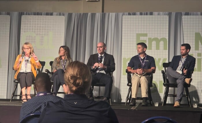
New Hampshire’s life sciences industry is expanding quickly, but the workers employers need range far beyond biomedical scientists — from manufacturing technicians and engineers to project managers, supply-chain specialists and finance professionals. At the Empower Life Sciences event hosted by…

It's still a fact in 2026 that New Hampshire has the second oldest population in the United States — 43.4 median age — tied with Vermont and topped only by Maine. Most senior citizens in New Hampshire say it's a great place to retire. But it depends on life's circumstances.

SB 482, which goes into effect in December, sets a daily conversion limit of $2,000 per digital transaction kiosks.

New report cites Tradeport’s ‘uniquely important role in New Hampshire’s economic architecture’ as executive director looks toward ‘retooling’ for life science users

After a 14-month construction mission, the “Apollo” landed at the Kelly Falls apartment complex this week with the completion of the Mark Stebbins Community Center, the culmination of a vision by the late Mark Stebbins, a long-time business leader and philanthropist.

Because of tariffs, the war with Iran, and other White House policies, New Hampshire families have had to spend an additional $4,800 or more on goods and services, according to U.S. Sen. Maggie Hassan, D-NH.