NHBR About Town: Week of July 17, 2026
Business and event happenings around the state of NH
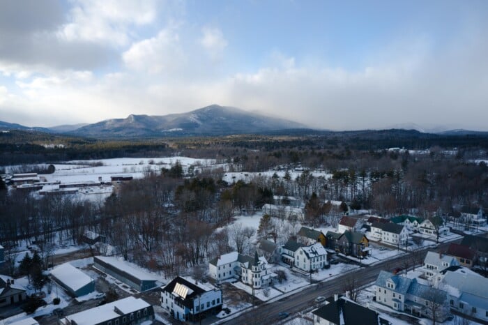
Blizzard-like conditions are expected in the region’s first major winter storm of the season.
Meteorologists predicted heavy snowfall, strong winds and a resulting low visibility during the weekend-long storm, which began making its way into the region late Friday night.
“The nastiest conditions will be Saturday afternoon,” National Weather Service meteorologist Kimberly Buttrick said Friday.
Buttrick predicted snowfall amounts at 12 to 18 inches during the heaviest part of the storm, expected after 3 p.m. today.
“That may be a conservative estimate, but that is what we are going with right now,” Buttrick said.
Winds during that time could be in the 20-30 mph range, she said.
Severe conditions were expected to continue throughout the night and should taper off by noon Sunday.
“There may be some scattered snow showers, but the bulk of the storm will be over by then,” Buttrick said.
On Friday, the agency issued a winter storm warning to last throughout Sunday.
Nashua city officials also issued a snow emergency for early morning hours of Sunday and Monday.
The snow emergency extends from today at midnight to 7 a.m. Sunday, and Sunday at midnight to 7 a.m. Monday.
No parking is allowed on city streets or municipal parking lots during the snow emergency and cars will be towed that violate the order.
However, parking garages will be open for free parking during the hours of the snow emergency.
The massive winter storm is actually the result of two storms, said senior broadcast meteorologist John Soldner of Hometown Forecast Services.
The first storm brought 4-8 inches of snow across parts of the Mid-Atlantic states throughout Friday, Soldner said.
That storm was expected to bring only snow flurries and light snow showers in the southern New Hampshire region as it moved over the region during the overnight hours, Soldner said.
However, that scenario would change with the introduction of a second storm, he said.
The second storm, which was moving eastward from the Ohio Valley early Friday evening, was expected to merge with the first storm early today.
“This second storm will intensify significantly on Saturday and Sunday night as it merges with the Mid-Atlantic coastal system,” Soldner said.
He said blizzard warnings were possible as northeast winds pick up steadily today and into the overnight hours.
“A blizzard warning means that winds will be sustained or will frequently gust at 35 mph or higher for at least a three-hour period with moderate to heavy snow falling . . . along with blowing and drifting snow creating very low to zero visibilities,” Soldner explained.
Throughout the week, many area residents stocked up on winter weather merchandise such as shovels, ice melt and snow-removal equipment as the storm continued to approach the region.
“Sales were very brisk this morning,” said Bill Richey, Sears store manager at the Pheasant Lane Mall.
Richey said the store is expecting a delivery of 120 snow throwers to keep up with the demand.
“It’s going to be an excellent weekend for snow-related goods,” Richey said.

Business and event happenings around the state of NH

The Latest is a roundup of the comings and goings of the movers and shakers in NH's business community
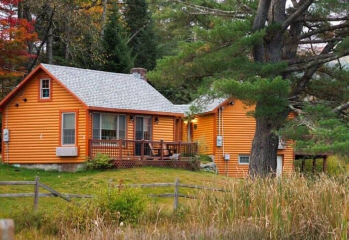
A decade after buying the property to redevelop it into a new generation of vacation cabins, the owner of Presidential Mountain Resort LLC (PMR) in Bethlehem has filed for bankruptcy protection in New York’s federal court, claiming more than $13 million in liabilities owed.

Failure to restore ACA tax cuts will only make things worse, according to U.S. Sen. Maggie Hassan

One of the things I enjoy most about working with New Hampshire business owners is hearing what they’re building toward. Whether it’s growth, succession or greater stability, our conversations are almost always about the future.

For many business owners, building wealth is closely tied to the success of the company. But as revenue grows and priorities shift, it can be difficult to know how much cash to keep available, how much to reinvest and when to begin planning for longer-term goals.

Succession planning for your business goes beyond naming the next leader. It involves preserving continuity for your employees and customers, as well as supporting the company’s long-term success.

As we close out Q2 and review the year so far, there are several interesting dynamics at play.

Londonderry’s Town Council is at odds over legal matters pertaining to hiring outside law firms to handle complaints and allegations of misconduct against the town manager.